From 2016 when I started acquiring multimedia assets from Psiloritis area, the intention was to use them in a virtual tour, however the hidden goal was to play with real life scenarios as an evolving workshop for learning purposes. This might have led to unfinished – unpolished applications and adequate post processed multimedia, however it gave me the opportunity to approach ways to implement web applications and recognize some of the challenges. These challenges vary from the chosen equipment, to organizing the trips for the photo shoots, the post processing of the material and the planning and implementing the applications.
Multimedia assets
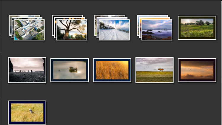
During this period from 2016 and on, I shot and recorded several hundreds of single and panoramic photos (stitched panoramas), aerial and time lapse videos and sounds.
- A time-lapse video can consist of 250 – 1000 photos depending on the aimed duration, the available time, the conditions, and the interest of the place I was shooting.
- The ground spherical panoramas, 10-20 shots depending on the area was required and for the aerial 24-40 shots, depending on the drone automated shootout for panoramas, the time of the day and the place.
So, currently this Lightroom catalogue contain almost 50000 individual files. Even though most of the material that I deemed worthy is used, there are a lot of aerial video clips that needs to be reviewed and potentially retouched and displayed in some of the applications.
The Applications
The applications built using these assets are virtual tours, multimedia galleries, interactive and story maps. Any of the applications can be embedded in a website. So, for example Psiloritis virtual tour is used in this page as an embedded slideshow.
Virtual tours
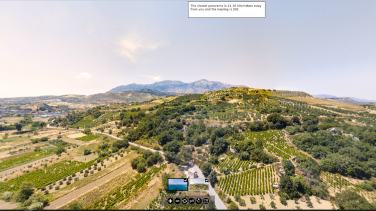
The main HTML5 virtual tour application can be found here
https://tours.nhmc.uoc.gr/geoparks/idi/index.htmlThe above slideshow that uses the same assets can be found here
http://tours.nhmc.uoc.gr/geoparks/idi/slideshow.html
Virtual tours are custom Pano2VR HTML5 websites with web XR capabilities. This means that they can be displayed in normal desktop and mobile browser (Chrome, Firefox, Edge, Safari etc) as a webpage, giving the ability to the user to control the panorama that he visits and the angle and field of view of the panorama that he sees by dragging the mouse or his finger. He also has the ability most of the times to zoom in and out in the panorama when it is a multiresolution one, so he can focus better on an area with better detail.
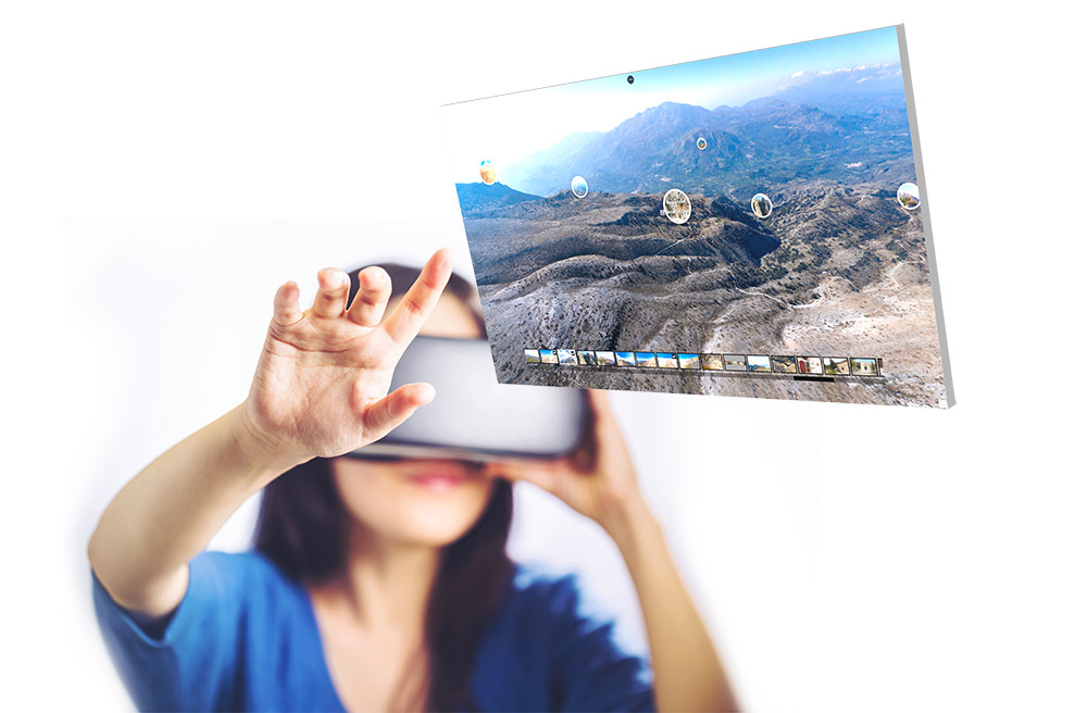
When the virtual tour is opened from a device that can support webXR – VR display, then a button appears in the menu bar, from which the user can activate the VR mode. This will split the display into two, one for each eye and activate the gyroscope of the device, to allow it to switch the angle of view, when the user is rotating it. In this mode many of the built-in capabilities of the normal website are deactivated and a minimal view is displayed, since a lot of the graphical elements of the app are hidden. There is the ability to open a more complete webXR app, however an external viewer / app is required, other than the normal browser of the device. This app can accommodate either the online websites, or local files that can be transferred to the device storage, for better and faster loading times.
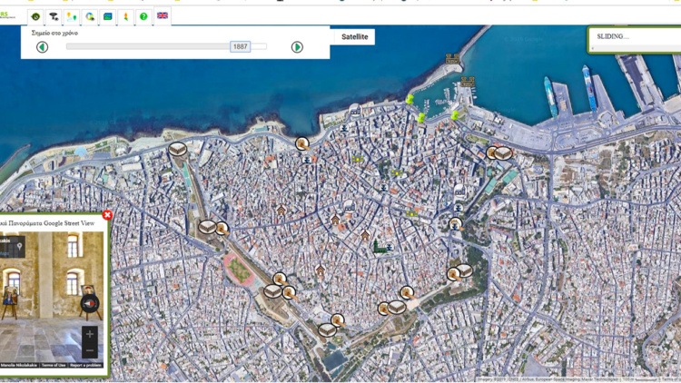
3D map combining the virtual tour
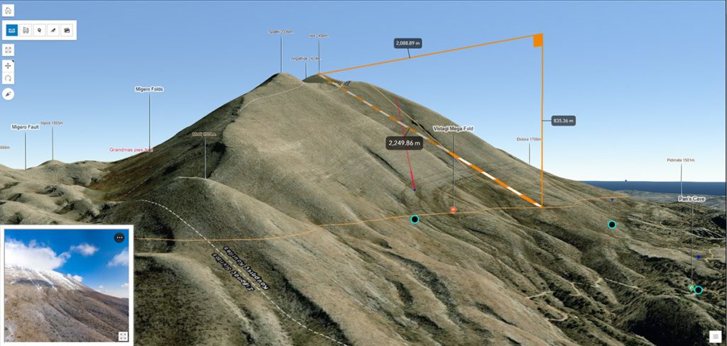
One of the unpolished applications that embeds Psiloritis geopark virtual tour can be found in the following link https://tours.nhmc.uoc.gr/geoparks/idi/map.
This is an ArcGIS javascript map containing one 3D web scene of Psiloritis and the user has the ability to rotate and control the map by using the spherical panoramas of the virtual tour. This gives the ability to lift the limitation of the inspection of one place from where the photographic panorama was shot and extend the experience by using the 3D map. Several points of interest are plotted in the 3D map that can be visible only by exploration, plus there is a spatially enabled photographic library. The ability to measure distance and area gives an extra tool to visualize the space and better understand the scale and the anaglyph.
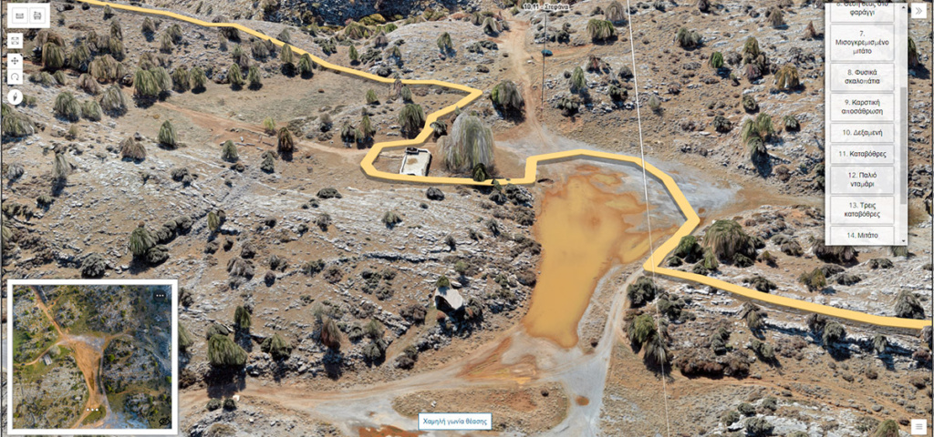
A variant app, that is available only in Greek, that follow the same logic is the ‘Trail of Mygia’ 3D map. This can be found in the following link https://tours.nhmc.uoc.gr/geoparks/mygia-new/map/. The Trail of Mygia is a proposed geo trail in Psiloritis geopark and it is far more smaller than the geopark. So instead of using the Satellite texture and the elevation of Psiloritis geopark, a new very high resolution ortho photo and digital elevation model was produced.