A presentation of the UNESCO Global Geopark of Psiloritis mountain was developed using ESRI ArcGIS Story maps. The story map is actualy a website compiled from textual information, introduction videos, interactive 2D and 3D maps, virtual tours and multimedia galleries and other websites. The Story Map of Psiloritis geopark is located in the following address https://tours.nhmc.uoc.gr/geoparks/map/idi/en/index.html.
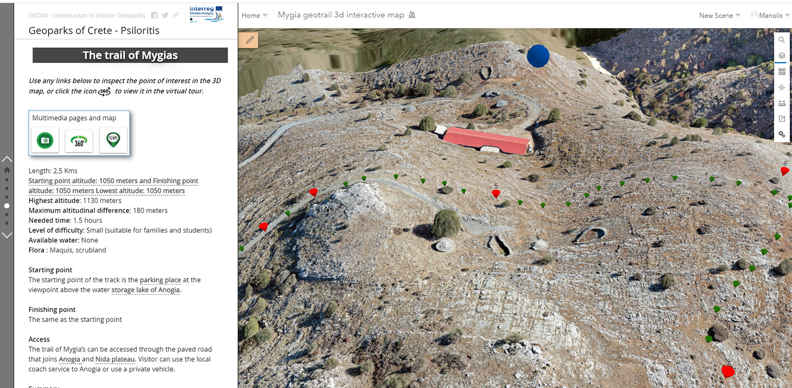
Mygia’s geotrail 3D interactive map
A 3D interactive map of the geo trail of Mygia near Anogia, was combined with the virtual tour of the respective trail. The 3D of the area was made using a drone to photograph the area and make a DSM (Digital Surface Model), along with an orthophoto mosaic of the area.These products were made with the use of Pix4D Control software to plan the drone flight paths and Pix4D Mapper to produce the photo mosaic and the DSM.
Psiloritis multimedia gallery
jAlbum is a great solution for presenting multimedia files as a web album. It comes with a lot of templates and has many customizable options to play with and change the look and alter the functionalities of the webpage. Since I made the Psiloritis web album